
If it is your first trip to the Red River Gorge, start with Sky Bridge, Chimney Top Rock and Natural Bridge for big views on short walks, then step up to Gray’s Arch or Auxier Ridge once you know how your legs feel. Here is how each one works, how long it takes and what to watch for.
The short list for first-timers
The Red River Gorge sits inside the Daniel Boone National Forest in eastern Kentucky, about an hour east of Lexington off the Mountain Parkway. The Forest Service says the Red River Gorge Geological Area holds more than 100 natural arches, which is the greatest concentration east of the Rocky Mountains. That is a lot of arches to choose from, and the trail map can look like a bowl of spaghetti the first time you open it.
So here is the shortcut. These are the hikes that give a beginner the most gorge for the least risk of getting lost or worn out. Distances are round trip and approximate, so treat them as a planning guide rather than gospel.
| Hike | Distance | Effort | Best for |
|---|---|---|---|
| Sky Bridge Loop | About 1 mile loop | Easy, with stairs | A first look at an arch you can walk across |
| Chimney Top Rock and Princess Arch | Under 2 miles | Easy | The classic overlook, 400 feet above the river |
| Natural Bridge (Original Trail plus Laurel Ridge) | About 0.5 mile up, 0.75 mile along the rim | Moderate climb, easy rim | The most famous arch, with a sky lift option |
| Whittleton Arch | About 2.5 miles | Easy | A shady creek walk to a big arch |
| Gray’s Arch | About 4 miles | Easy to moderate | Your first “real” hike, with a big payoff |
| Auxier Ridge and Courthouse Rock | About 5 miles | Moderate | Ridge-top views for a confident beginner |
Sky Bridge Loop: the easiest arch to start with
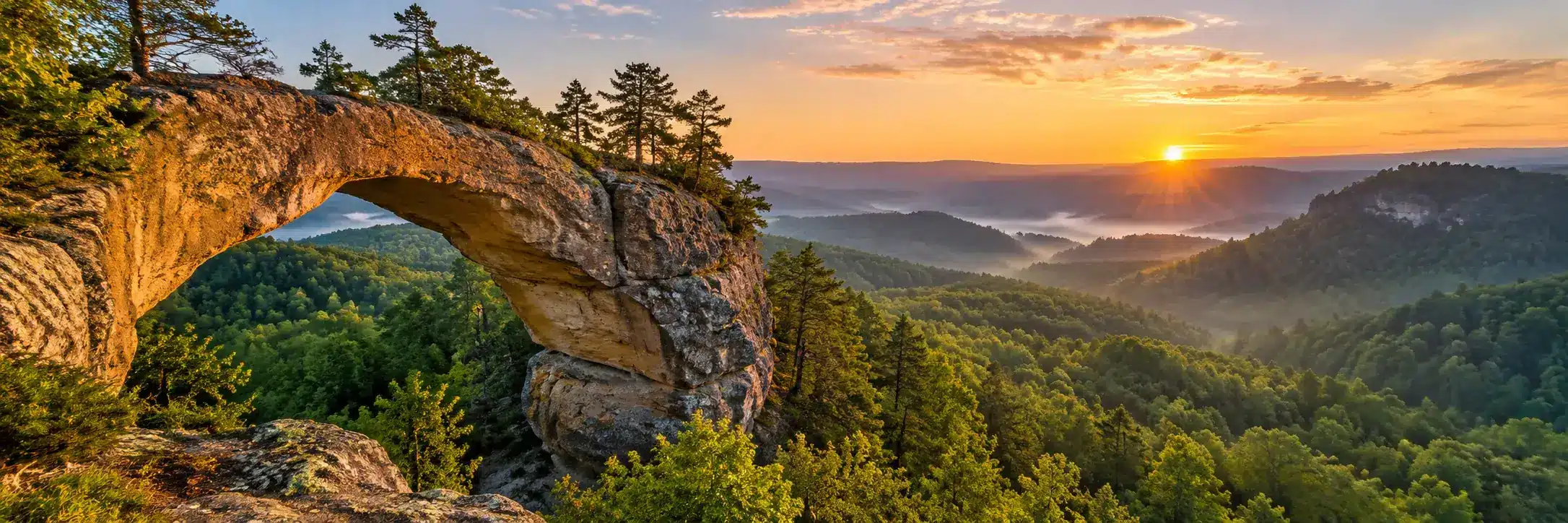
Sky Bridge sits off Sky Bridge Road (Forest Road 245), a short drive from the Gladie Visitor Center. According to the Forest Service, the arch is 23 feet high and 75 feet long, and Sky Bridge Arch Trail #214 makes a loop that goes over the arch, under it and back along a high cliff shelf.
Kentucky Tourism puts the loop at about a mile, with the first stretch paved and a staircase on the way down. The catch is the top of the arch itself: it is narrow, it is high and there is no railing in places. Keep small kids by the hand and keep dogs leashed. If heights bother you, you can still enjoy the walk underneath.
There are picnic tables and a vault toilet at the trailhead, and no fee to park.
Chimney Top Rock and Princess Arch: the big view for little effort
Chimney Top Overlook sits at the end of Chimney Top Road (Forest Road 10). The Forest Service describes it as towering 400 feet above the Red River, with sweeping views across the gorge. From the same parking area, Chimney Top Trail #235 leads out to the rock and Princess Arch Trail #233 leads to a slender arch you can walk over and under.
Both walks are short, which is exactly why this is a great sunset stop after a longer hike elsewhere. Just remember that short does not mean safe at the edge. The overlook ends in a sheer drop. Stay behind the railing and on the trail, and do not walk the rim after dark.
There is no drinking water here, so fill your bottles before you head up the road.
Natural Bridge: the famous one, with a lift if you want it
Natural Bridge is inside Natural Bridge State Resort Park, right next to the national forest. Kentucky Tourism describes the arch as more than 75 feet long and 65 feet high. You can walk across the top.
Kentucky State Parks lists The Original Trail at about half a mile with roughly 500 feet of elevation change, past old CCC shelters and hemlocks. It is short but it climbs, so take it slow. Once you are on top, Laurel Ridge Trail runs about 0.75 mile along the cliff rim to Lover’s Leap, an easy walk with a big view.
If climbing is not your thing, the park’s sky lift carries you up to the ridge, and a short path connects the lift to the bridge. Check current lift hours and prices with the park before you plan around it, since they change with the season. We go deeper on the park in our Natural Bridge State Resort Park guide.
Whittleton Arch: a shady creek walk
Whittleton Arch is a good pick on a hot day. The walk follows a creek through a cool, shaded hollow before reaching the arch, and local trail guides put it at about 2.5 miles round trip with an easy rating. It starts near the Whittleton area of Natural Bridge State Resort Park, so it pairs nicely with a Natural Bridge morning.
Expect wet rocks and roots near the water. Shoes with real grip matter more here than on the paved stretch at Sky Bridge.
Gray’s Arch: your first real hike
When you are ready for something longer, Gray’s Arch is the usual next step. The trailhead is the Grays Arch Picnic Area on Tunnel Ridge Road (Forest Road 39). The Forest Service gives these directions: take exit 33 at Slade off the Mountain Parkway, turn left and then right onto KY 15, go 3 miles and turn left onto Tunnel Ridge Road. The picnic area is less than a mile in on the right. It is day use only, from 6 a.m. to 10 p.m., with a vault toilet and no drinking water.
Grays Arch Trail #205 leaves from here, and local guides put the out-and-back at about 4 miles. Most of the walk is fairly gentle, then the trail drops toward the arch with stairs and steeper sections. Remember that whatever you go down, you climb back up at the end. You will see people scrambling on the arch. Do not join them. The view from the base is the good part anyway.
Auxier Ridge and Courthouse Rock: big views for a confident beginner
Drive to the end of Tunnel Ridge Road, about 3 miles in, and you reach the Auxier Ridge parking area. Auxier Ridge Trail #204 runs out along a narrow sandstone ridge with views down both sides, and Courthouse Rock Trail #202 makes a loop off it, dropping below the cliff along an old logging road to a big rock formation that looks a bit like a courthouse. Local guides put the combined loop at about 5 miles.
This is a fantastic hike, but parts of the ridge are exposed with long drops on either side. Skip it in high wind, ice or thunderstorms, and keep a close eye on kids and dogs. Tunnel Ridge Road gets very busy on weekends and holidays, so arrive early.
Before you go
- Park only in designated lots. The Forest Service says roadside parking on Tunnel Ridge Road is not permitted.
- Bring all your water. The trailheads above list no drinking water. Our Red River Gorge packing list covers how much to carry.
- Plan to be off the cliffs before dark. Cliff edges are the big hazard in the gorge, and they are much harder to see once the light goes. Daylight, good shoes and staying on the trail are your best protection.
- Staying past 10 p.m.? Vehicles parked overnight for backcountry camping in the gorge need a recreation pass displayed. Details are in our camping guide.
- Stop at the Gladie Visitor Center at 3451 Sky Bridge Road for maps and current trail conditions. The Forest Service lists it as open daily 10 a.m. to 5 p.m., closed on federal holidays, but call ahead at 606-768-3341 if you are counting on it.
- Check current conditions. Storms, closures and road work change things. Look at the Daniel Boone National Forest alerts page before you leave home.
If the gorge has already got its hooks in you, these are the pieces people pick up after a first trip.
 Red River Gorge Enamel Camp Mug: Red River Gorge. One More Trail, Forest Ink Stamp$32.95See it →
 Red River Gorge Die-Cut Magnet: Red River Gorge Is My Scenic Detour, Woodland Scenic Lettering Price range: $14.95 through $22.95See it →
 Red River Gorge Vinyl Sticker: Kentucky Looks Better from the Trail, Vintage Round Badge Price range: $14.95 through $22.95See it →
A simple first-day plan
Here is an easy way to string the short hikes together without backtracking too much.
- Morning: Natural Bridge via The Original Trail, then out along Laurel Ridge to Lover’s Leap. Ride the sky lift down if your knees ask nicely.
- Lunch: Grab food in Slade or pack a picnic for the Sky Bridge tables.
- Afternoon: Sky Bridge Loop, with a stop at the Gladie Visitor Center on the way.
- Evening: Chimney Top Rock for the late light, then out before full dark.
Day two, if you have one, is Gray’s Arch or Auxier Ridge, started early before the lots fill. If you are still deciding when to come, our guide to the best time to visit the Red River Gorge walks through the seasons.
Questions people ask
What is the easiest hike in the Red River Gorge?
Sky Bridge Loop and the short walks at Chimney Top Overlook are the easiest. Sky Bridge is about a mile with a paved start, and Chimney Top is a short walk from the parking lot to a big overlook.
Do you need a permit to hike the Red River Gorge?
Not for day hiking at the trailheads covered here, which list no fee. If your vehicle will be parked overnight for backcountry camping between 10 p.m. and 6 a.m., the Forest Service requires a recreation pass displayed in it.
Is the Red River Gorge good for kids?
Yes, with care. Sky Bridge, Natural Bridge and Whittleton Arch are good family hikes. The danger is the cliff edges, so hold hands near drop-offs and keep everyone on the marked trail.
How long does it take to hike to Gray’s Arch?
Plan on two to three hours for the roughly 4 mile round trip, including time at the arch. The climb back out at the end is what slows most people down.
Can you hike the Red River Gorge in one day?
You can see a lot in one day by stacking short hikes like Natural Bridge, Sky Bridge and Chimney Top Rock. To add a longer trail like Auxier Ridge, give yourself a second day.
More in Red River Gorge.